The Desert Speaks; 1701; Exploring Arizona’s Big Empty
- Transcript
You
It's big it's empty. It's desert and it's relatively unknown Arizona strip has some Long time residents of this stuff is a story past and it's in a very famous Neighborhood this is the edge my gosh it's here
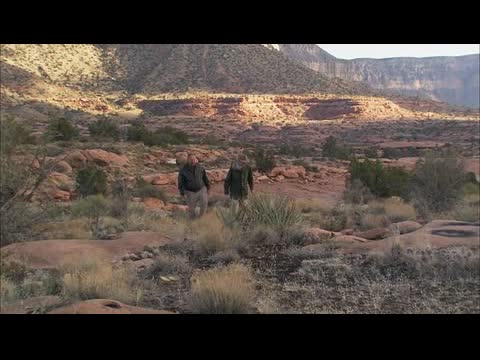
One of the least known places in Arizona or the western United States for that matter lies in the northwest corner of Arizona rough Topography absence of water and accidents of history have left this huge area Almost completely undeveloped it's more than just a strip of land but it's called The Arizona strip Two friends of mine are savvy historians and tough outdoorsman their ecologist Yarr patrician and archaeologist jock favor their ideal
companions for a plunge into What some people call big Grand Canyon was a great barrier from anybody coming from the south trying to Get north to the strip and into Utah as well from there leaves very at this spot Was one of the only crossings at the east end and you'd have to go 300 miles plus to The west end of Pierce landing which is now Lake Mead to come in from the west so the Arizona strip is really isolated geographically from the south and politically from Utah To the north Apparently it was intended to be a crossing for a long time to look at these buildings Very close 1928 after a tragic accident the mail carrier man named Nez and two other Men lost their life crossing the river they closed the
ferry at that time and they kept It closed because the bridge was under construction at that time the Navajo bridge was completed 1929 it's just down the river After that these places were vacant and it was abandoned then for a few decades until Somebody figured out it's the best place to start running the Colorado river and now Tens of thousands of people come here for that purpose and look for condors and Whatever else like a goat The old timers had a lot of walking and climbing to do to get from here to there They had to go along the edge of the echo cliffs there to these ferry where they can Cross and then they had to come up along this side of the Colorado river along the Vermillion cliffs until they pass them
into the flats they could see the promise land Over there would take them three days to get there because they go all that way to Leaves ferry before they could cross west of the Navajo bridge you come across the Vermillion cliffs once you look at them you realize why they're called Vermillion Cliffs the iron oxides really come out and the sun hitting it just lights them up with Different shades of reds and orange most of the cliffs are silt stones and sand stones Starting back in the Triassic 230 million years ago there was tremendous amount of Block faulting where huge blocks have been uplifted or dropped Vermillion cliffs are a result of that look at these big boulders Wow it is a great field yeah this is wonderful when these boulders tumbled down The underlying silt stone was right there at the bottom of them and over time the Silt stone eroded much
much quicker than a shinrump and a pedestal has formed If you look around you can see big boulders of the shinrump conglomerate laying on the Ground eventually the underlying silt stone will be eroded and they'll end up on Pedestals looks like giant mushroom the erosion factors here are both wind and rain You can almost imagine in a huge summer thunderstorm there's a little arroyo here With the force of the water carrying little pieces of silt just water gravel hitting this It's going to tear it away almost as you before your very eyes Oh yeah and a real big flood the gusher would just really rip right through here And you know the ironic thing is that if this gets eroded too much we eventually will This is going to tumble hopefully while we're not here and then the process starts all over again And I want you to notice the cap rock here got little pebbles in it And that's why it's a conglomerate That's a conglomerate yeah and I think that I'll watch it from out here because it's cloudy And another rain might
come up because look how top heavy that is Now let's uh let's move on The Arizona Strip was too tough for many people to settle But for millions of years it was the perfect place for North America's biggest bird That is until late in the 19th when humans and condors clashed and condors lost How long has the Paragon Fund been involved in working with the condors? Well our first release was in December of 1996 but we came in about mid 1995 This site was chosen basically for its proximity to the Kaibab Plateau The food supply that's available there as well as the lack of proximity to developed areas and a lot of human travel The first step of course is producing the birds in captivity Basically they're fed and held in there in seclusion with as little human
activity as possible Until we move them to the release pin from the release pin They spend a few weeks there interacting in some way and observing the free flying birds feeding on carcasses Things like that and then they're released So we try to maintain as little human contact as possible while as much as possible having contact with the free flying birds What we have here is a GPS transmitter that has a solar array They wear this? They wear this on their wing, on the leading edge of their wing It's got a little solar panel on it Well that's terrific and that's their number so you can see that with a scope You can tell which bird it is From a mile away you can get pretty good visuals from a mile away And this has a GPS unit in it? A GPS just as in your handheld unit, it collects information all day and then uploads to satellite once per day So these points on the screen here are an overlaid onto a topographic map program using GIS software That we can actually plot the birds for as few as just a few hours ago So they can actually see
where they are as a couple hours ago and follow their movements Almost live, not quite live Almost live and it allows us to direct the biologist to exactly where the birds were last known to be The California condors are strictly opportunistic scavengers and they utilize winds Either created by updrafts from desert floor heating up Or in this case during this time of year the topography you see here and prevailing winds They can soar for all day and throughout the year foraging for food and utilize very little energy And doing so which allows them to go 7, 10, 14 days without feeding So they're very efficient scavengers and they make a living by investigating areas of activity This is basically a condor hospital, is that accurate? Yeah, Field Hospital If a bird does need care
or would otherwise probably die then we will intervene at this stage Because we are trying to stack the odds and favor the condor in these early years And interestingly through all of the years now of capturing birds and treating them We've not had a bird deemed unreleasable or hurt bad enough to not be released I'd say that the number one threats, the ones that we focus on are the ones that we can do something about Let's get her weighed So obviously toxins that affect the birds directly like lead poisoning Where we've found pathways for lead to get into carcasses that condors are eating I'd say those are the ones we focus on the most because we can do something about it Slow to come around But she's still alive Lead poisoning is an issue with the condors here in Arizona It's actually the leading cause of mortality And we know that one pathway they're getting this lead from
Is from incidentally ingesting carcasses that actually have spent lead ammunition in them And game and fish since we're involved with hunting We can actually do a lot in this department So what we do is public education You can see this copper bullet right here in mushrooms upon impact It has 98 to 100 % weight retention Now in comparison a lead bullet they can fragment up to hundreds of pieces Upon impact of a deer or an elk something like that So what happens is they fragment into small pieces And the condors actually ingest those when they eat the carcass or the gut pile Actually that's also a big issue So this way the condors are less likely to ingest this large piece of bullet And also it's less toxic than lead In the next 7 to 10 years we should have a population large enough That when we retract our management, our intensive management And nature's hand is allowed to come down and strike the population I think at that point we'll then know what this area will support The Arizona strip, how many condors will
be supported Departing from the condor research facilities We leave paved roads and all other amenities behind Headed for the steepest and most isolated overlook of the Grand Canyon Now we've got to check out this sign I get the feeling they're trying to call our attention to certain features Here on the Arizona strip Yeah, especially this road to Tora Wheat Point No glasses of water No gasoline No gasoline, apparently there's no telephones I have no idea what that means And then no eating facilities and no mechanics No mechanics, that doesn't mean there are no forks in the road So let's boogie A long way to go 60 miles of fun and enjoyment Look
how desolate it looks ahead of us One person's desolation is another person's eating That's true I've heard that Arizona strip called the Big Empty And today it's the Big Muddy The Big Empty Muddy, huh? It is, but it does go on and on Just forever We're still in Arizona And this is a desert, but this is not the warm Sonoran Desert No, the low -lying areas of the Arizona strip Is around 5 ,000 feet But there's parts of it, of course, that's much higher But at this elevation you get a lot of desert -adapted plants But also cold -adapted Yeah, yeah So this is considered a cold desert A high cold desert Now they say that Sagebrush rivals Creosote for smelling good after rain It's just rained up here It has a real strong smell Slightly chemical, but pleasant, too
But I guess one big factor about the lack of people in the Arizona strip Is it's really hard to find permanent water And that makes it hard for big herds of cows Most of the water that's here is really disperse parts Typically in foothills, over the springs This is the Toroip Valley It's a word that appears to mean in Paiute, dry valley When Europeans arrived here, they had a hard time with that word So they shortened it to two -weep Which is the way it appears on maps But its real name is Toroip You notice that once again in the Grand Canyon formations The road got a whole lot rougher Yeah, because we're on rock We're on solid rock Got here the Paiutes who had to know this country just intimately They must have had
a certain queasy sensation The first time they came down here and saw the rim of the canyon Yeah, considering the rest of the strip is relatively flat With hills and small peaks But to come across the gorge like Salva said It almost seems as the closer you get to the canyon The greater the differences in vegetation from up Sort of in the flatter, higher part of the strip Yeah, we've actually been increasing in elevation Down in the flats where we saw grasses and sagebrushes and so forth As we climbed up, we started getting an opinion juniper Stunted trees and even there for a while some pines I tell you, that last ten miles or so Was nice to drop back down and get out of the salt It's mucky clay due to the limestones and sandstones here
As far as I can tell, we've arrived at Toroip Yeah These rocks here in the middle of the lot here Suggest they don't want us to go any farther I don't think you want to either From what I remember from 22 years ago This is a spectacular view Well, let's see if it's, it is what it's cut out to be The straightest shot to the bottom in the whole Grand Canyon It is, from this viewpoint here at Toroip This is the limit This is the southern limit of the Arizona strip Wow, you know, this is the edge My gosh, it's sheer That's got to be, I think it's 3 ,000 feet straight down at this point You can actually hear the rapids You've to take a photograph No farther than this My
friends don't want me to go any farther than this Well, I don't know about that Well, yeah, but who said you were my friend? If you look at what is above us And it's spectacular in its own right Then you get here to the edge And look into the inner gorge And you're looking at 1 .8 billion year old Vishnu shit Clear at the bottom, that's a lower layer So, you've got a lot of geological history That's exposed here Most of the recent geological work Seemed to indicate that it was carved In about 6 million years The canyon itself Before that carving was done, there was no Arizona strip No, because it was just straight across That's right And if I had to stay that way Why we'd have condominiums Virtually all the way up to the Virgin River St. George, Utah So, thanks to the river, my warm regards Great work A wonderful finish, that's for sure So, we better get our stuff packed And move on It's hard to leave
Well, we gotta find a campsite We're losing our son I don't know about your tent But mine's got all the comforts home Mine does too A pillow From this point where we're at It would take hours to get to a place Where there's a motel or hotel So, camping it is Hey, you suppose we've got a little mud? It's gonna get colder, mate You know, for just a little A few days up in Arizona strip We've got a whole pot full of equipment The ground's gonna be real wet tonight The more insulation you've got underneath The better off you're gonna be Tent is up That's bad The vegetation here in the Arizona strip Gets real characteristic as you get close to the canyon
Yeah, and what we're seeing here Is a lot of desert adapted plants Yeah, I'll say look how we have to Step gingerly to get around the prickly You gotta watch where you're stepping But there's a couple of types of prickly pear This hedgehog right here You've the yucca And one of my favorites here Is this little prickly pear Called grizzly pear prickly pear Yeah, it's well named It does look like a grizz It does All those spines on there But they're really cute I expect you should stay away from them too The way you should stay away from your grizz But it really is I mean, this is desert vegetation Oh, this is all desert And you'll see that it's kind of stunted Because of the cold during the winter Got one great thing about this Supi formation is on the plant It's full of these depressions And when it rains They got pools everywhere Yeah, they're seasonal and temporary But we're very important for the wildlife And even the native peoples Oh man, it's cold 36 degrees, 37 degrees This
nondescript mound Called Vulcan's Throne Looks like just an ordinary hill But a million years ago It was explosive Producing more volcanic activity Than anywhere in the western United States Now, it looks like just another ordinary hill This is Utah Gavi And it was very important To the native peoples here They would take the heart of the gavi Cut all the leaves off And roast it And they would roast it So that's real important Yeah, really And plus they used the leaf for fibers It's real fibers Yeah, you'd make rope So these pods Full of seeds Little black seeds And they're actually edible They could grind them And with, say, pignon nuts And make a meal out of them They were edible Perhaps not the best thing in the world But nutritious And another interesting plant Here's a Utah juniper And it does produce those juniper berries Oh yeah, you put them in
gin But more important See this shaggy bark? Look at that Oh yeah, it's real soft Well, before the days of toilet paper They'd just kind of pulverize it like that And it would use it as toilet paper And also as... Wait, who would? The native peoples And the pioneers as No way I'm going to try that I believe you And for material for diapers It doesn't absorb it Oh, it was useful stuff though It's kind of hard to believe But a lot of native peoples Thought these little hedgehog cactuses Were pretty But if had an ear infection You could cut off some of the spines And take the pulp And if you put a drop of that pulp Just squeeze it into the ear It would cure the infection It's widely known And I suspect there's a lot of truth into it I mean, how do people figure this stuff out? Good to know Yeah, it's good to know Next time you have one Here it is And what happened to the prickly Look at this So we're going to have to get close to notice What's happening here Somebody's been eating prickly pear Yeah,
see this big old chunk missing here And how ragged it is And look at the droppings here So this was a rabbit Pretty desperate for some moisture Gotta be hard And he was chewing on this Well, you didn't want them green So why not? But there's been a prolonged drought in this area And animals are desperate Anywhere you wander around out here in this country You'll find evidence of early occupants On these sites It's mostly lithic materials So first you just look for lithics What is that? Well, like this? Yeah, like this right here These were the tools then We to make a livin' Which was pretty tough to say the least Most of this stuff is early man chippings Archaic culture Fleshing tools These belong out here on the land If everybody picks them up There won't be any
left So they're best left right on the ground Where they are This is more of a hunting area This grassland They'd be coming through here Wandering through a hunting larger game Most of the campsites are closer To a little water source For food gathering areas Where they would actually stay put for a while Historic settlers left behind remnants That show they had an even harder time Living on the strip Than the pre -Columbians did It's a very small structure I'll give you a nickel If you can decipher the sign It says two -weep church Barely legible Two -weep church It looks like the sign has burnt down Since it was mounted on the structure Well no doubt in the late 1800s When the Mormons first arrived It looked pretty good out here They stayed and stocked it to their capacity On a good year it was really good But on a bad year it was really bad
Water is always a problem out here There's very little live water And it would all be catchmen and tanks On a dry year it would be mighty tough Well, there's got to be a better way to make a living They figured that out You don't see too many of them around now The immensity and mystery of the Grand Canyon Overshadowed the natural wonders Of the Arizona Strip Yet it's because of the canyon And the wild topography of the Colorado Plateau That the strip has been pretty much left alone Most of those who know it Hope that these 7 ,000 -some square miles Will remain wild and undeveloped forever So this Navajo Bridge Just replaced the Lease Ferry Crossing And I think it probably
accommodated A few more vehicles over its 70 years of life or so Quite a bit safer to cross, I'd say It also sort of connects the Navajo Reservation With this whole other part of the Arizona Strip Which is under all sorts of different land ownership You You
You One of the least known places in Arizona Or the western United States, for that matter Lies in the northwest corner of Arizona Rough topography, absence of water And accidents of history Have left this huge area almost
Lake Mead to come in from the west So the Arizona Strip is really isolated Geographically from the south And politically from Utah to the north Apparently it was intended to be a crossing for us The at that time, they kept it closed Because the bridge was under construction at that time The Navajo Bridge was completed in 1929 It's just down the river In seclusion with as little human activity as possible Until we And game and fish, since we're involved with hunting We can actually do a lot in this department So what we do is public education Tools that we use to make a living Which was pretty tough to say the least So this Navajo Bridge Just replaced the Lies Ferry Crossing And I think it probably accommodated a few more vehicles
Over 70 years of life or so Quite a bit safer to cross, I'd say It also sort of connects the Navajo Reservation With this whole other part of the Arizona Strip Which is under all sorts of different land ownership
You
- Series
- The Desert Speaks
- Episode Number
- 1701
- Episode
- Exploring Arizona’s Big Empty
- Producing Organization
- Arizona Public Media
- AAPB ID
- cpb-aacip-360a231998f
If you have more information about this item than what is given here, or if you have concerns about this record, we want to know! Contact us, indicating the AAPB ID (cpb-aacip-360a231998f).
- Description
- Episode Description
- No description currently available.
- Created Date
- 2007
- Asset type
- Episode
- Genres
- Documentary
- Topics
- Geography
- Local Communities
- Nature
- Media type
- Moving Image
- Credits
-
-
Producing Organization:
Arizona Public Media
- AAPB Contributor Holdings
-
Arizona Public Media
Identifier: cpb-aacip-4d2e7f8711d (Filename)
Format: HDCAM
Generation: Master
If you have a copy of this asset and would like us to add it to our catalog, please contact us.
- Citations
- Chicago: “The Desert Speaks; 1701; Exploring Arizona’s Big Empty,” 2007, American Archive of Public Broadcasting (GBH and the Library of Congress), Boston, MA and Washington, DC, accessed July 3, 2026, http://americanarchive.org/catalog/cpb-aacip-360a231998f.
- MLA: “The Desert Speaks; 1701; Exploring Arizona’s Big Empty.” 2007. American Archive of Public Broadcasting (GBH and the Library of Congress), Boston, MA and Washington, DC. Web. July 3, 2026. <http://americanarchive.org/catalog/cpb-aacip-360a231998f>.
- APA: The Desert Speaks; 1701; Exploring Arizona’s Big Empty. Boston, MA: American Archive of Public Broadcasting (GBH and the Library of Congress), Boston, MA and Washington, DC. Retrieved from http://americanarchive.org/catalog/cpb-aacip-360a231998f